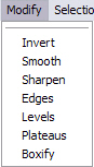
Modify
The Modify menu provides you with access to a number of filters designed to help refine the grayscale height field you are working on. Click on any of the filters in the image below to go to that filter.
Invert
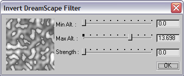
This filter inverts your height field values. All areas that were black become white and vice versa.
Min and Max Altitude - These sliders control the altitude ranges that will be affected by this filter.
Strength - Smoothes the edges of inverted areas.
Example: For this sample terrain in the Preview window, we'll assume that the Terra Height is 20, Minimum Altitude is 3 and Maximum Altitude is 12. The Strength slider will go from 0 to Terra Height/2 (in this example 10). If the Strength slider is set to 3.0, it will begin to affect altitude values between the Min Alt. and Max Alt. limits. Above 3.0 it will only affect values up to the Max Alt. limit up to difference between Max Alt. and Min Alt. divided by 2 (in this case (12-3)/2=4.5). We refer to this as the 'DIF'.
The Strength factor effects Min Alt. and Max Alt. values separately. If the Min Alt. value is closer to 0 then half way to the Max Alt. value, it will affect all values up to Min Alt. Otherwise it will affect values up to the DIF value. The same is true for the Max Alt. value, only its calculation is set regarding to Terra Height.
|
|
|
|
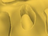
Strength = 0.0 |
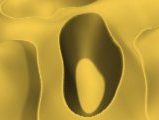
Strength = 1.5 |
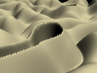
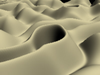
Smooth
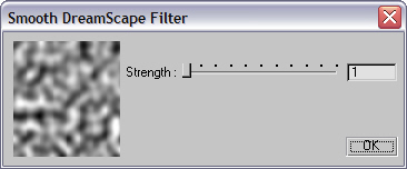
This filter "smoothes" the Terrain height values.
Strength - Represents the number of smooth iterations applied to your Terrain. The Smooth strength goes from 0 to 10.
|
|
|
|
Smooth Off |
Smooth On (value of 3) |
Sharpen

This filter "sharpens" the Terrain height values.
Strength - This slider controls the number of sharpen iterations applied to your Terrain. The Sharpen strength goes from 0 to 10.
|
|
|
|
Sharpen Off |
Sharpen On (value of 2) |
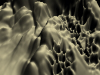
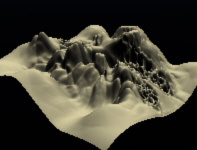
Edges
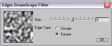
This filter "smoothes" the Terrain grid's edges.
Size - Negative size values will raise the edges; positive values will lower them.
Edge Type - This parameter lets you choose between a Circular or Square spreading type. Using Circular is a great way to create quick islands since you can flatten out all of the surrounding height field.
|
|
|
|
Edges Off |
Edges On (Circular) |
Levels
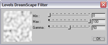
The Levels filter will lower or raise the terrain and can also alter the overall slope angles for the entire terrain based on a Gamma setting. This lets you make modifications to the entire height field globally.
Min. and Max. Altitude - Represents limits within this filter will be applied.
Gamma - Use this slider to set the intensity of this effect. If set to 10, height values remain unchanged.
|
|
|
|
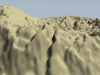
Levels Off |
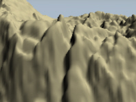
Levels On (Gamma adjusted to alter terrain slope) |
Plateaus
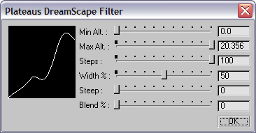
This filter applies a plateau effect on the Terrain's height values
Min. and Max. Altitude - Represents the limits within which this filter will be applied.
Steps - Determines the number of plateaus applied. The higher the value, the less of a 'stepped' look you will get.
Width % - Describes the percentage of the plateau width that will not be affected by the Steep factor.
Steep - This parameter determines how much of the original terrain profile will remain between plateaus.
A Steep value of 0 represents the original height value; higher values give you more parabolic curvature between plateaus.
Blend % - Represents the percentage influence of the original height value to the currently calculated value.
|
|
|
|
Plateaus Off |
Plateaus On |
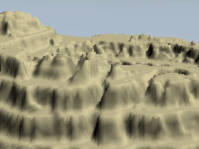
Boxify
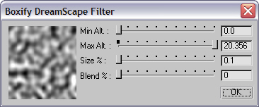
This filter applies a special boxify effect on Terrain height values.
Min. and Max. Altitude - Represents the limits within which this filter will be applied.
Size - Controls the size of each cell.
Blend - Represents the percentile influence of the original height value.
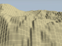
Boxify On